 |
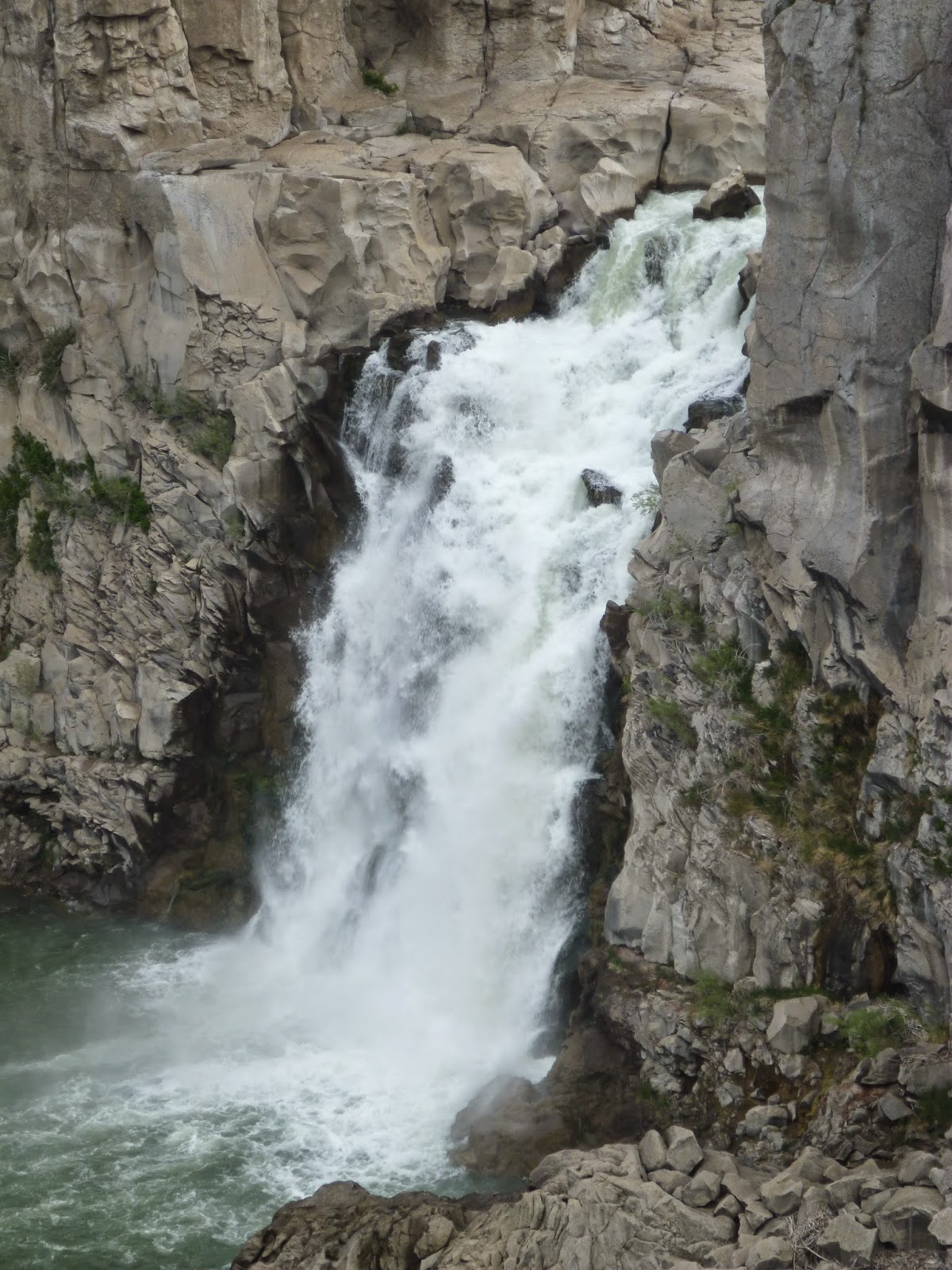
| Shoshone Falls |
Because much of its length runs through dry country that was originally quite sparsely settled, the Snake (and the Columbia) has been heavily dammed to produce hydroelectric power and to divert water for irrigation of farm crops.
In South-Central Idaho between Pocatello and Boise, the Snake runs through a series of canyons that were at least greatly enlarged by the great Bonneville Flood about 15,000 years ago. Wikipedia says:
At the peak of the flood, approximately 33,000,000 cubic feet per second (930,000 m3/s) poured over the Snake River Plain at a speed of 70 miles (110 km) per hour and deposited hundreds of square miles of sediments eroded from upstream. The flood scoured the 600-foot (180 m)-deep Snake River Canyon through the underlying basalt and loess soil, creating Shoshone Falls and several other waterfalls along the Snake River. It also carved and increased in size many other tributary canyons, including those of the Bruneau River and Salmon Falls Creek. Eventually, water also spilled down the Bear River into the plain. The flood then entered Hells Canyon, significantly widening the gorge. Its waters eventually reached the Pacific Ocean via the Columbia River.Just for comparison purposes, I note that the flow of the world's largest river, the Amazon, is a bit over 200,000 cubic feet per second on average. So this flood was 165 times that volume.
I visited a couple of these falls with my parents this week driving home from Hailey, Idaho. The diversion of water for irrigation along with the current drought conditions in the western US have contributed to making the waterfall quite small compared to what they used to be.
Here is a rundown on two of them.
Shoshone Falls
Named after the Shoshone Tribe, it is pronounced locally as "show-shone" with a silent e at the end. The Oregon Trail ran along the banks of the Snake River through southern Idaho and the falls were famously known as the "Niagara of the West". The falls are actually higher, at 212 feet versus Niagara's 167. However, while Niagara has a typical flow of 85,000 cubic feet per second, Shoshone's flow was never anywhere close to that and currently runs around 3500 cubic feet per second on average. The falls are high enough that they effectively blocked salmon from running any further upstream.


With the abundant rain from the past few weeks the falls
were running higher than normal when we visited on Wednesday. But this
was still a pretty low flow as can be seen by the photo at the beginning
of this post. By contrast, here is a colorized photo from the late 1800's before the dams were built upstream. Below is an old photo from one of the information kiosks at the falls which also illustrates the difference.


Shoshone Falls is located a few miles upstream from the town of Twin Falls, Idaho. Oddly, the falls after which the town are named lie a few more miles upstream from Shoshone. Below is a view of the falls prior to its damming in 1935.

In 1935 the southern falls was dammed entirely and a large arch dam was built behind the north falls. Excess water is channeled through the large basalt island in the middle from the south dam and exits part way down the north channel, so there is one partial falls left
 |
| Stitched Panorama of the Arch Dam (Shot through Chain-link Fence) |


 |
| Stitched Panorama |


No comments:
Post a Comment